Shipping Estimate
USA
- USA
- CAN
- USA
- CAN
Ships within 48 hours · Estimated delivery Jul 7 - Jul 12
For Your Every Summer RSVP, with Code: SUMMER15
Description
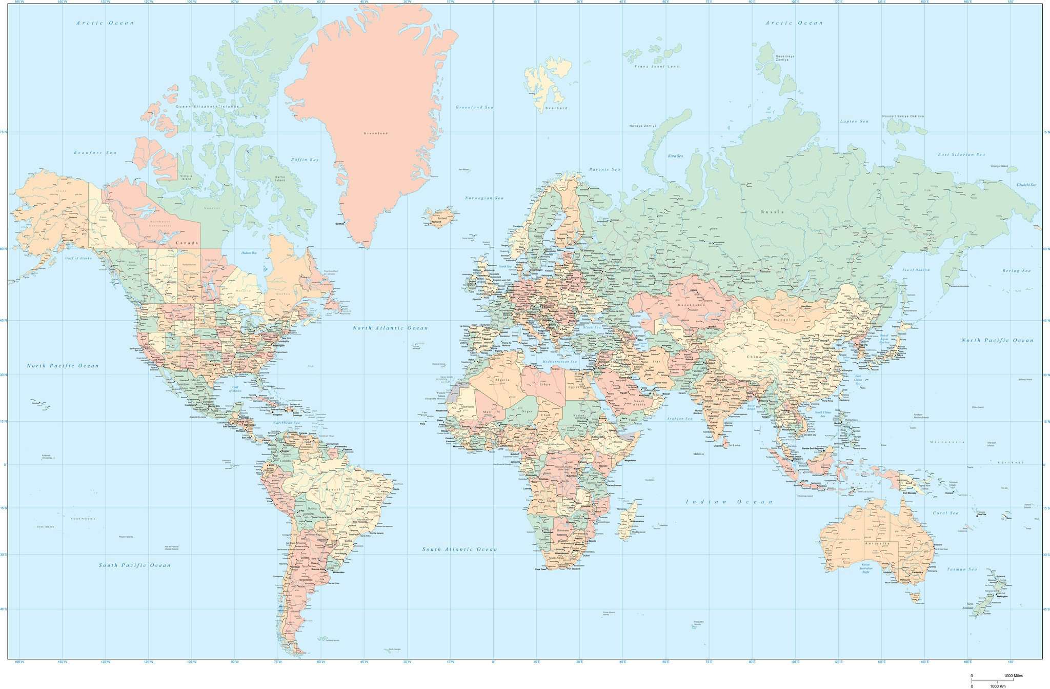
55 x 35 Inch World Map with US States and Canadian Provinces - Small Text SizeAbout This Detailed World Map Shows country borders, country names, US states, Canadian provinces, major rivers, lakes, roads, and cities. In Illustrator format each area is a separate object you can select and change the color. All lines are fully editable, and all text is fully editable font text (not outlines). Dimensions about 55 x 35 in (140 x 89 cm). Perfect for large size posters or presentations or trade show graphics. Mercator Projection.
About This Detailed World Map
Shows country borders, country names, US states, Canadian provinces, major rivers, lakes, roads, and cities.In Illustrator format each area is a separate object you can select and change the color. All lines are fully editable, and all text is fully editable font text (not outlines).
Dimensions about 55 x 35 in (140 x 89 cm). Perfect for large size posters or presentations or trade show graphics.
Mercator Projection.
Shipping Notes
- Free Standard Shipping on $100+ Orders to the USA.
- Except Preorder products are shipped in 48 hours.
- Delivery to the USA:
- Standard Shipping : 3-10 business days
- If time is of the essence, please consider selecting expedited delivery for faster service.
Exchange/Return Notes
- We offer a 30-day return/exchange service after receiving.
- Final sale items are not eligible for returns or exchanges.
- To process your return/exchange, please contact us at [email protected]
- Please click here for more details>>> Return & Exchange Policy